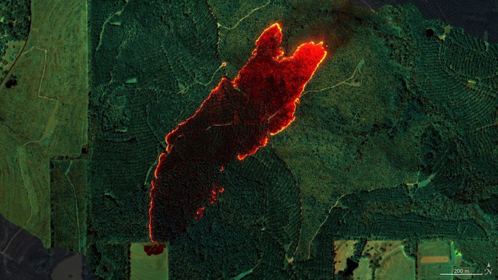
Data from the AVIRIS-3 sensor was recently used to create detailed fire maps in minutes, enabling firefighters in Alabama to limit the spread of wildfires and save buildings. A NASA sensor recently brought a new approach to battling wildfire, providing real-time data that helped firefighters in the field contain a blaze in Alabama…
Read More